When Every Gas Station Was a Library: How America's Free Map Culture Vanished Overnight
When Every Gas Station Was a Library: How America's Free Map Culture Vanished Overnight
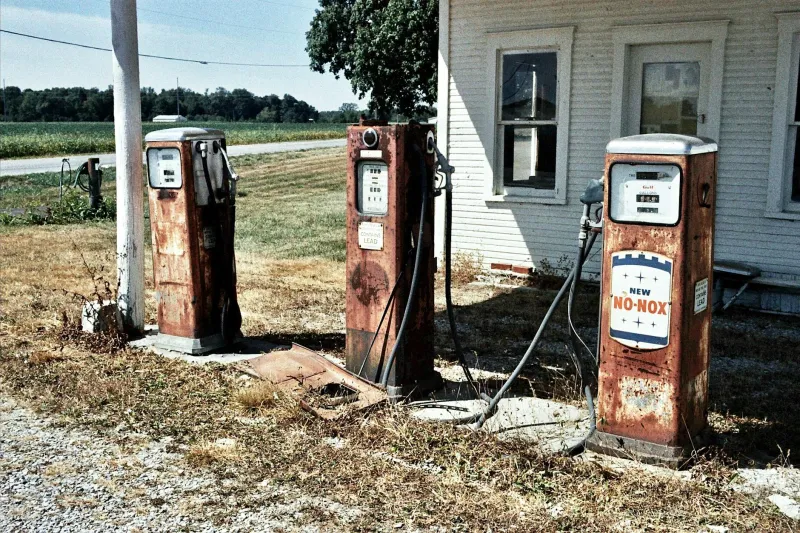
Pull into any gas station today and you'll find energy drinks, overpriced snacks, and lottery tickets. But walk into that same station thirty years ago, and you'd discover something that seems almost quaint now: racks upon racks of free road maps, meticulously maintained and regularly updated, covering every corner of America.
This wasn't some small-scale operation. By the 1970s, oil companies were printing over 250 million free maps annually. Texaco alone distributed 10 million maps each year, while Gulf Oil's cartography department employed dozens of full-time mapmakers. These weren't afterthoughts—they were marketing gold, brand ambassadors folded into neat rectangles that travelers would keep in their glove compartments for years.
The Golden Age of Paper Navigation
The free gas station map represented something remarkable in American commerce: a genuinely useful product given away to build customer loyalty. Oil companies competed not just on gas prices, but on cartographic accuracy. Rand McNally worked exclusively with different brands, creating maps so detailed they included individual rest stops and scenic overlooks.
Shell's maps became legendary among truckers for their precision on back roads. Esso (later Exxon) maps featured the clearest typography. Standard Oil's California maps included beach access points that locals guarded like state secrets. Each brand developed its own visual language, its own interpretation of the American landscape.
For travelers, collecting these maps became an unconscious habit. You'd grab one for your destination state, maybe pick up a neighboring state "just in case," and before you knew it, your glove compartment contained a paper atlas of everywhere you'd been or planned to go.
The Ritual of Planning
Before MapQuest, before GPS, before Google Maps, planning a road trip meant spreading maps across your kitchen table like a general plotting a campaign. You'd trace routes with your finger, calculate distances with a ruler, and make notes in the margins about gas stops and interesting detours.
This physical interaction with geography created a different relationship with travel. You understood the scale of America in a way that's hard to replicate on a smartphone screen. You could see how the Rockies divided the country, how the Mississippi River system spread like veins across the heartland, how the Interstate Highway System connected distant cities in ways that seemed almost magical.
Families would gather around these maps, debating routes and discovering places they'd never heard of. "What's this Mammoth Cave thing in Kentucky?" "Why does this road just stop in the middle of Nevada?" The map became a conversation starter, a planning tool, and an educational device all at once.
The Economics of Free
What made the gas station map economy work was brilliant in its simplicity. Oil companies understood that travelers needed gas, and travelers needed directions. By providing both, they created customer loyalty that lasted for generations. A family might choose Shell over Texaco not because of gas prices, but because Dad preferred Shell's map layout.
The maps cost pennies to produce but generated enormous goodwill. They kept the company name visible in customers' cars for months or years. Every time you unfolded that Mobil map to check a route, you saw the Mobil logo. It was advertising that provided genuine value, creating positive associations with the brand.
Gas station attendants became amateur travel advisors, recommending routes and highlighting interesting stops on the maps they handed out. This personal touch turned a simple transaction into a moment of human connection—something that feels almost revolutionary in today's self-service world.
The Digital Disruption
The end came faster than anyone expected. MapQuest launched in 1996, but it wasn't until the mid-2000s that digital mapping began seriously threatening paper maps. Then the iPhone arrived in 2007, and within five years, the entire gas station map ecosystem had essentially collapsed.
By 2010, most major oil companies had stopped producing maps entirely. The printing presses that had run continuously for decades went silent. Cartography departments that had employed hundreds of people were disbanded almost overnight. An entire industry—one that had operated profitably for nearly a century—simply vanished.
What We Actually Lost
It's easy to dismiss this as nostalgic romanticism. Digital maps are objectively better in almost every way: they're always updated, they provide turn-by-turn directions, they show real-time traffic. But something genuine was lost in the transition.
We lost the serendipity of discovering interesting places while studying a map. We lost the satisfaction of successfully navigating by landmarks and intuition. We lost the shared experience of families gathering around a map to plan adventures. Most importantly, we lost a uniquely American institution that connected commerce, geography, and wanderlust in ways that felt natural and beneficial to everyone involved.
The gas station map represented something that's increasingly rare in modern life: a corporate product that genuinely improved people's experiences without hidden costs or manipulative design. It was capitalism at its most benevolent, creating value for customers while building brand loyalty through usefulness rather than addiction.
Today, we navigate with surgical precision but explore with less wonder. We arrive at our destinations efficiently but discover fewer surprises along the way. Progress isn't always loss, but sometimes it's worth acknowledging what we traded away for convenience—even when that trade was obviously worth making.